|
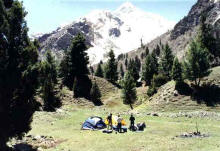
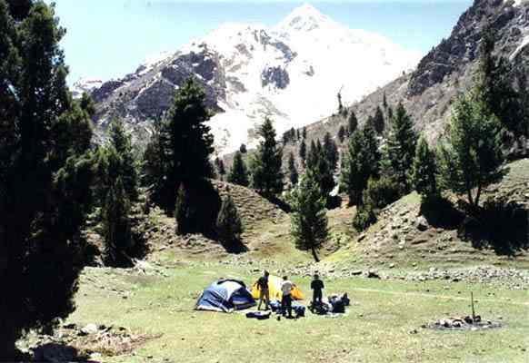
Naltar Valley,
Gilgit |
Gilgit valley
At an elevation of 1,454
metres lies the Gilgit Valley. The quaint little town of Gilgit has spectacular
scenic beauty. The peak tourist season is from May to mid-October though the
tourist season is round the year. The maximum temperature in May is 33 C and the
minimum 16 C and in September Maximum 28 C and minimum 11C.
10 Kms. from Gilgit town is
a beautiful rock engraving of Buddha of 7th century A.D.at the mouth
of the Kargah Nullah. A victory monument of Taj Mughal, built 700 years ago, is
30 kms. Jeep drive from Gilgit town.The bridge over the fast
flowing Gilgit river is the largest suspension bridge in Asia (182 metres long
and 2 metres wide) permitting enough room for one jeep at a time to cross.
Sports
The favourite sport in
Gilgit is polo which local folks claim originated here. It’s more rugged,
free-style version than the sedate variety known in the plains. The polo
tournament held from 1st November to 7th November is a festive
occasion and draws a large number of visitors.
Angling
The streams and lakes of
Gilgit are full of trout. These are at kargah Nullah 10 kms. from Gilgit, Singal
56 kms. Gakuch 73 kms. and Phandar 117 kms. from Gilgit. Permits for fishing are
issued by the Assistant Director, Fisheries, Government of Pakistan, Gilgit.
Trekking
& Hiking
Trekking and hiking in the
rugged mountains and verdant valleys of Gilgit are allowed only in the
"open zone" which extends up to 16 kms. short of the cease-fire on the
Kashmir border and up to 50 kms. short of the Afghan border. Guides are
available at PTDC Motel, Gilgit. However, applications for obtaining permission
to bring a trekking group for restricted zone into the country should reach the
Ministry of Tourism by 31st December alongwith a map indicating the
route within three months of the expiry of the last date for the receipt of
applications. The names, passport numbers, place of issue, must also be
submitted to the Ministry of Tourism.
Mountaineering
Around Gilgit are towering
mountain peaks, waiting to be scaled. Permits for mountaineering are issued by
the Ministry of Tourism, Government of Pakistan, Islamabad.
How
to Get There
By Air: PIA operates two
daily flights between Islamabad and Gilgit. All flights are subject to good
weather. The flying times is one hour and one way fare is approximately US$ 44
for foreigners.
By Road: Gilgit is also
accessible from Islamabad/Rawalpindi by the Karakoram Highway. Rawalpindi to
Gilgit via Swat is 750 kms and takes 20 hours by bus/van; Rawalpindi to Gilgit
via Babusar Pass 592 kms 24 hours by jeep. Regular bus, wagon services
operate on the Karakoram Highway between Rawalpindi and Gilgit.
Where
to Stay
Gilgit has a number of
comfortable furnished and reasonably priced cottage-hotels, motels including
PTDC’s Chinar Inn, and rest-houses.
For assistance, please
Contact:
Tourist
Information Centre
JSR Plaza, near PIA Office
Gilgit
Tel (92-572) 3939